Posts

Showing posts from December, 2021

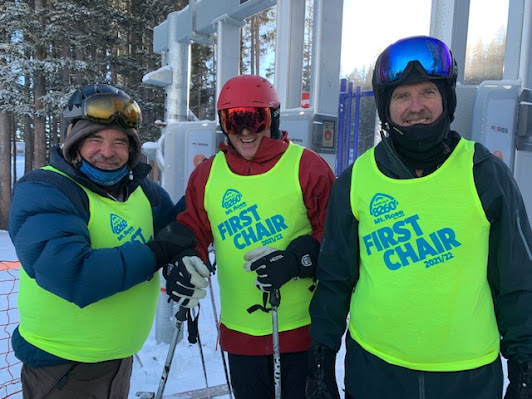
Auntie Em, Auntie Em...

Image
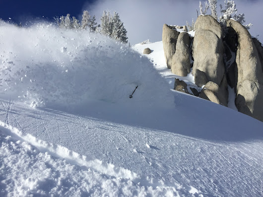
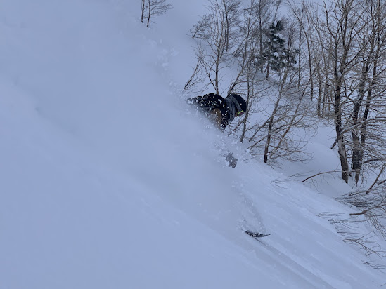
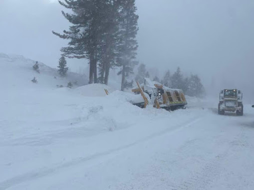
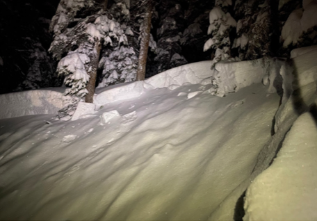
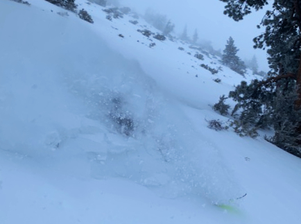
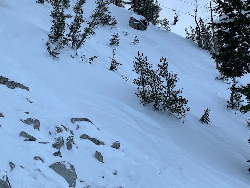
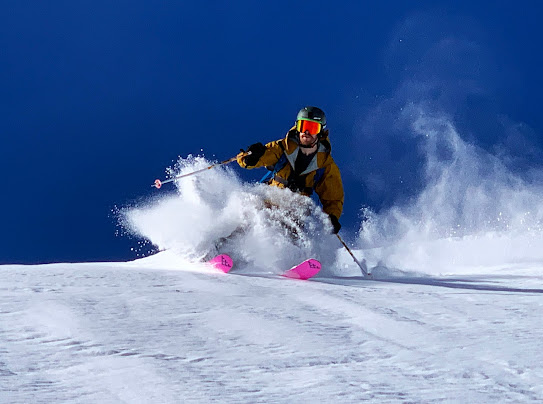
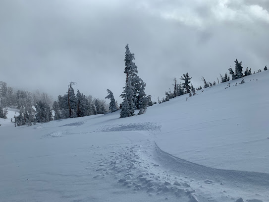
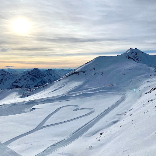
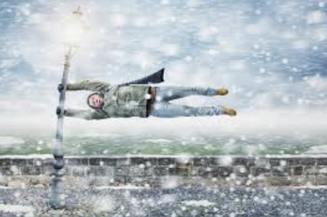
 Yeah... so the Cold Front that blew through yesterday slammed what was once impeccably beautiful light dendrite crystals into wind packed round balls that formed windslab and sastrugi. The SW and W winds were strong enough to rotor down onto most exposures and if that didn't do it the switch to the North winds last night took care of the rest. There still exist some very protected powder pockets if you poke around but the wind sure did a number on the almost perfect conditions we had earlier in the week. So it goes. Hope you got out there when it was good because... it was really really good from top to bottom and beyond. Those of you that got into the BC know just what I mean. All that wind loading did result in some slides here and there but generally damage was limited.  Crowds were thick as flies on a rib roast today (as Uncle Eddie would say) judging from the parade of cars traveling very slowly up the highway in the morning. I am sure conditions remain good on the mountain (

Hard to go wrong...

Image
 Slide opened this morning along with the parking lot  followed by the chutes in the afternoon, although I was out in the BC after Slide tracked out. Good skiing all around with nice cold temps and reduced winds. First tracks on slide were delicious. Experienced a few small slabs of new snow in the BC on the steeps but all in all the snow has stabilized nicely in general. Some cold weather coming up without blinding whiteouts... time to get out there! Skiing conditions are excellent with Rocky Mountain quality pow! Sven

431 is way way done...

Image
 It has been an epic storm up here in the Carson Range with close to zero vis much of the time due to the hurricane force winds and heavy snow. The drifts are bigger than I have ever seen up here and the snow hasn't stopped for the better part of a week. Low vis and machines are often poor soulmates as the pics below attest... pic one is of an NDOT rotary ditched out on 431 and the little red smudge you see to the right of the tree at the end of the orange rescue line is a Mt. Rose Ski Area snowcat down in Winter's Creek. The operator certainly experienced a Mr. Toads Wild Ride as he was clearing the Slide lot. I would estimate we have had about 8'+ of snow the last four days which happens to be the exact number our friends over at: www.tahoeweatherblog.com predicted. Great job over there gentlemen!  With all the wind transport some slopes will be ready to slide on a hair trigger... be careful out there tomorrow should the resort and highway reopen.  Sven

Time to be Care Full!

Image
 Its been howling up here the last 3 days pretty much non-stop so many slopes have been wind loaded and will be slabby for awhile, especially with another two feet forecast for tonight. A skier was killed in the slide crown photo below in Colorado recently on a windslab so, PLEASE be careful and do your due diligence when probing into the BC tomorrow or Tuesday. Some slopes may have a hair trigger, especially in the Carson Range where the winds have been whipping. If you don't know, don't go. And even if you do go, remember to dig some evaluation pits looking for layering, practice good route selection and have your avy kits and know how to use them.  Hopefully you can be Care Full when you go out for some turns and not let the Sirens of Powder seduce you into a line you had hesitations about. Above all, listen to that voice whispering in your head, beyond all the shovel shear tests, pit evaluations and understanding the wind direction and snow transport, your subconscious may

Get Out There...

Image
Merry Christmas... and what a gift we have all received... unless like me you're at the wrong end of a shovel. In any event I have only three words of advice, GET OUT THERE. We haven't had a dump like this since 2017. Unbelievable how much snow has fallen. Here is a shot of one of Rose's Groomer carrying on the Dave Hahl tradition... working with his skis instead of a cat... If you plan on going BC. Do take heed, the windloading is extreme. Choose your path wisely.  Sven

Groomers Improved & a Chutes Warning

Image
 Greetings all on Solstice Eve,  The sun will finally stop its downward descent on the horizon and from tomorrow morning on will once again edge up higher on the horizon each day toward summer's zenith. Hope you celebrate the very middle of winter with a run or two in the days and weeks to come. According to the forecasts from our friends at tahoe weather blog it will be worth it. To keep up with storm forecasts go check out his Carson Range based forecasts at: www.tahoeweatherblog.com. As of now we are slated for between 4 to 5 feet by weeks end.  Firstly though I wanted to comment on the numerous complaints about the lack of grooming of some of the slopes this weekend or poor quality of the grooming that was done on Ida's and others. After some investigation I have discovered three valid points that led us to this junction: 1) Dave Hahl, a 30 year grooming wizard at Mt. Rose, whose commitment to perfection and variety and number of slopes groomed is legendary across the Tahoe

A weekend of Surprises...

Image
 Some of the sweetest lines ever to be had both in the BC and inbounds when The Chutes opened a little after noon. Beehive brought smiles all around as the snow had stayed put unlike other chutes. Although the skiers left of Nightmare went according to it's namesake, it was actually Jackpot that fared the worst with a 10 foot crown just 25 feet inside the gate. The slide was big enough to take a lot of snow down to the run out and leave a lot of boulders just waiting for your p-tex. Oddly enough the debris was mostly soft and skiable in the runout making for some fun nature groomed turns at the bottom. Cardiac Ridge needed an ER doc at the bottom for the Heart Attack Victims, needs much more snow. What hasn't slid out is rock laden... often just under the surface. Chutes were fairly uncrowded and you could easily score a half dozen without crossing too many tracks. Ian Dwyer shows us how it's done below. On another note entirely our friends over at tahoeweatherblog.com are

The Best Pow Day in Years!

Image
NW opened on time, the Iron Curtain wasn't up and Slide was spinning in feet of fresh pow under sunny morning skies. As we drifted over the top and down Golds and then both sides and then the trees toward Zephyr skis and smiles were flying. It was, in a word, perfect. In every way.  Sven

Winds: Check before coming up

 Winds have come up much earlier than the forecast portended. Check lift status before coming up the road. Blowing down here at Sky 25 mph gusts this morning and weather is forecast to deteriorate over the day as the next Winter Storm comes in. 

Deep Pow Ahead! Mountain Opens Tomorrow

Image
 Some storm skiing brought some smiles yesterday as Nate Corona proves below on a run down Slide Access. Tomorrow Rose will open with sunnier weather and deeper pow. Wish I could be there but gotta work. Y'all have a great time and YES, I'm jealous as hell.  Go Deep For Me,  Sven

It's coming to a mountain near you...

Image
Rose was closed today but you wouldn't have wanted to ski it anyway... blowing like hell up here.   With upwards of five to six feet of snow forecast for Slide Mountain and the road being closed, most folks elected to do more Christmas shopping or prepare their yard for Snowmegeddon than find a way to Rose yesterday. That made for very short lines for NW first thing in the morning... about a dozen folks lined up for first chair. I stayed till 10 in perfect groomed conditions on KC and left before NW went on windhold. Knew it was coming but one hour of skiing is equal to about 5 days of happiness doing anything else so it was well worth it. Caught some nice shots of the sun blazing through blowing crystals from the snowmakers. It was beautiful to be sure. Snowmakers now working on the Slide side and after this storms we should be open on both sides very soon! Sven

Opening a Fine Day Indeed

Image
 Came early. Got it. Left early. Back at work near 10 am. Sure felt good though and it was a perfect day, clear skies, sun, perfect groomers. What else could you ask for with the exception of 3 to 6 more feet of snow, but wait. That is coming. Expect the end of the weekend to be white all the way into Tuesday. NWS just upgraded the Sunday through Tuesday storm to a Winter Storm Warning with a forecast of between 3 to 6 feet of new.  Looks like it will be a White Christmas... Below are the "usual suspects" at first chair hamming it up with the latest Rose fashion statements. Sven

Wax Up: Rose Opens this Friday!

Image
 With fantastic work by George and his snowmaking crew Rose will open this Friday on a very limited base and list of open runs... it will be top to bottom skiing however. So... wax those boards and prep for a weekend of skiing for the first time in seven plus months! Sven

Where we are at right now snow wise...

Image
 Daniel Swain of Weather West just uploaded the latest guidance for our Snow Drought and its as widespread as it is intense. Here is the latest... Sven

Winter is coming...

Image
Pouring over meteorological computer models our friends over at: www.tahoeweatherblog.com are advertising a big change in the weather come Wednesday with snow dropping down to most elevations and temps 10 to 15 degrees colder. NOAA is calling for temps in the single digits in mountain valleys and possibly subzero temps in particularly cold locations. We could receive as much as a foot of natural white stuff but the guns will surely be cranking out the manmade as well. Given the weather I can't imagine the mountain will stay closed.  Although rain at 7600 feet today for the most part as this "storm" was still quite warm, the storm toward the end of this week will not be warm and will open the storm door for more action next week. Looks like we will finally have a winter moving in! Stay tuned for Rose news... we should know something soon! Sven

White stuff in hard to come by in the West...

Image
 Looking at November snow totals we are working with pretty low numbers all across the West Coast. Most places are well under the 50th percentile and some still sit near zero (that's us). Interestingly, even the NW which has had more than its share of precipitation this month is still shy of snow due to the fact that their storms arrived laden with subtropical moisture and much higher snow levels than average leaving them soggy and muddy but still brown. Given that, I would say our weather has been pretty darn enjoyable.  There looks to be a change in the larger weather patterns next week so don't fret too much about the current lack of snow. According to the law of averages (and our friends over at www.tahoeweatherblog.com) the snow will come soon enough. Here is a look around the West of where we are at.  Sven